Maritime shipping and transport form the backbone of the global economy. According to reports by United Nations Conference on Trade and Development (UNCTAD), more than 80% of global trade by volume is carried by sea, with approximately 11 billion tons of cargo transported worldwide each year. Given this profound reliance on maritime transport, navigation emerges as a fully integrated system that combines specialized scientific knowledge, advanced technologies, and highly skilled human expertise.
Maritime navigation extends far beyond the simple movement of a vessel from one port to another. It is a precise discipline grounded in complex astronomical calculations, meteorological analysis, the study of ocean currents, and the application of satellite systems—supported by deliberate and decisive human judgment to ensure both voyage safety and operational efficiency.
The Hidden Architecture of Navigational Safety:
Maritime navigation does not rely solely on technology. Robust backup systems are in place to maintain guidance in the event of electronic failure. Voyage routes are planned using sophisticated predictive weather models; avoiding a single major storm can reduce fuel consumption by up to 10%, while simultaneously lowering operational risks.
The Evolution of Navigation Methods Through History:
Navigation techniques have evolved progressively over time, including:
Today, modern vessels depend on integrated systems that combine satellite technology, radar, Automatic Identification Systems (AIS), Electronic Chart Display and Information Systems (ECDIS), and satellite-supported GPS. This technological integration has significantly enhanced positional accuracy—often to within a few meters—while increasing operational reliability. As a result, mariners are able to manage voyages with greater efficiency under diverse and challenging conditions.
This progression raises fundamental questions about how positioning has been determined from antiquity to the present day:
Despite rapid technological advancement, celestial navigation remains an essential contingency method. Mariners can determine latitude with acceptable precision by measuring the angle of the sun or referencing Polaris (the North Star) when electronic systems fail. This enduring integration of astronomical science with modern technology represents a key pillar of sustainable navigational safety.
Ocean currents directly affect voyage efficiency in terms of fuel consumption and transit time. Harnessing favorable currents can shorten sailing duration, whereas navigating against them significantly increases fuel usage. Deep winds and storms also impact vessel stability and the safety of containers and cargo, necessitating meticulous planning and continuous monitoring of maritime conditions.
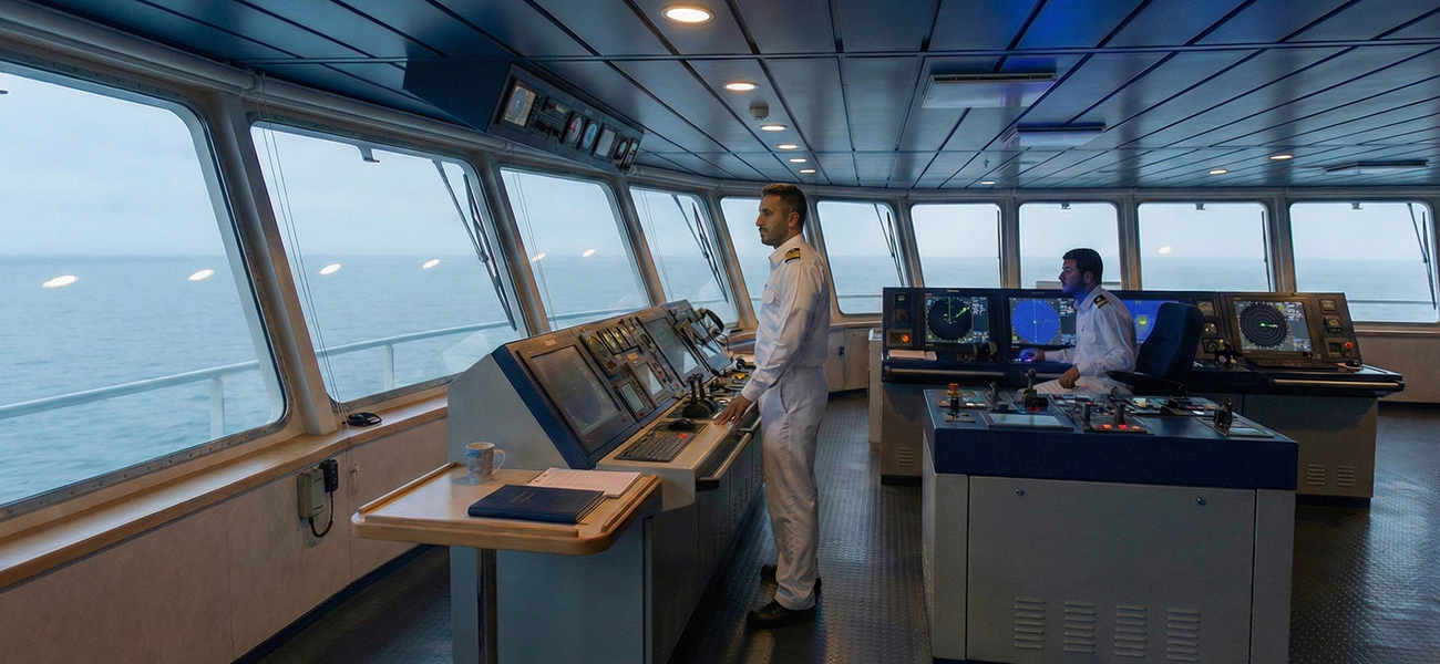
The Human Element in Supporting Modern Systems
Despite accelerating digital transformation, the human factor remains central to maritime navigation. While technological systems provide precise data, they do not replace professional judgment. The ship’s master ultimately balances weather conditions, vessel status, cargo characteristics, and schedule requirements to ensure a safe and efficient voyage.
In an era of rapid technological change, maritime navigation remains a discipline that unites mathematical precision with human expertise. It is an integrated framework in which technology intersects with astronomy, natural forces, and strategic decision-making. As global trade continues to expand, the science and art of maritime navigation will remain a fundamental pillar in safeguarding the efficiency and safety of sea transport worldwide.